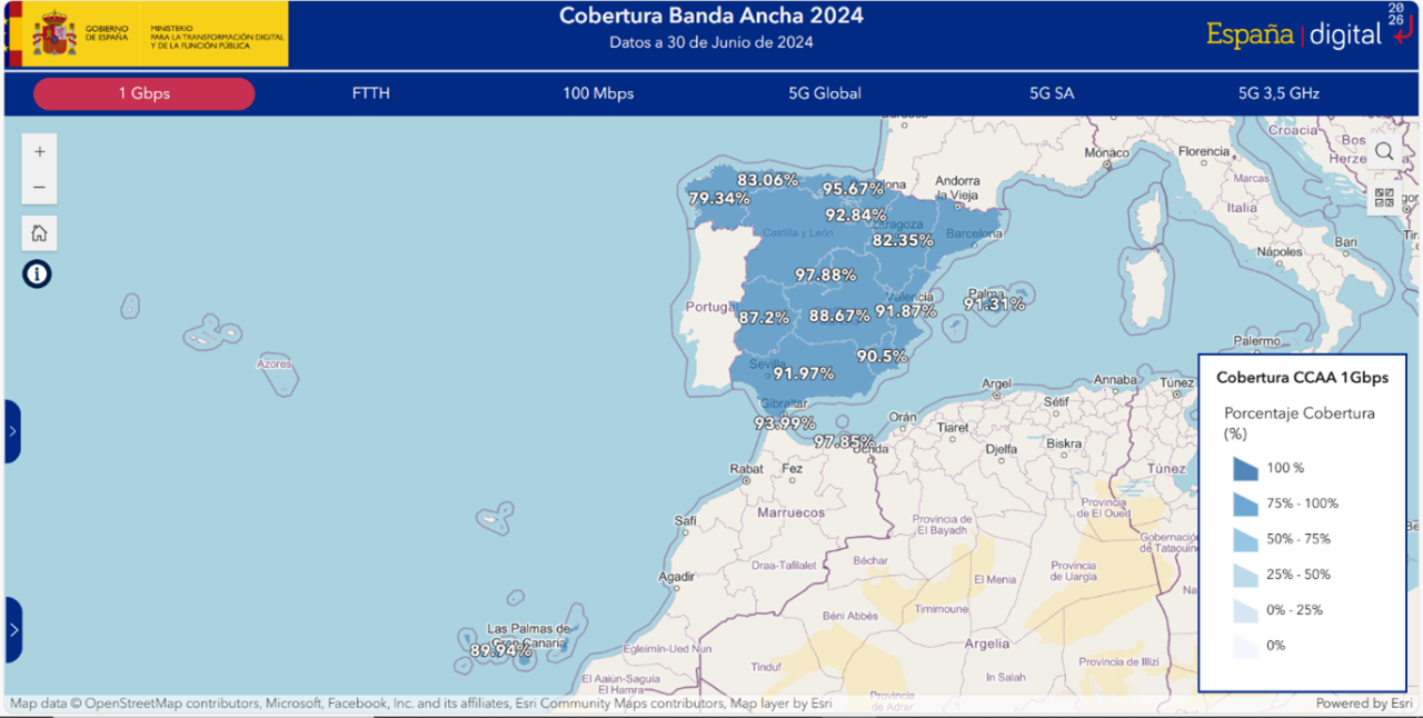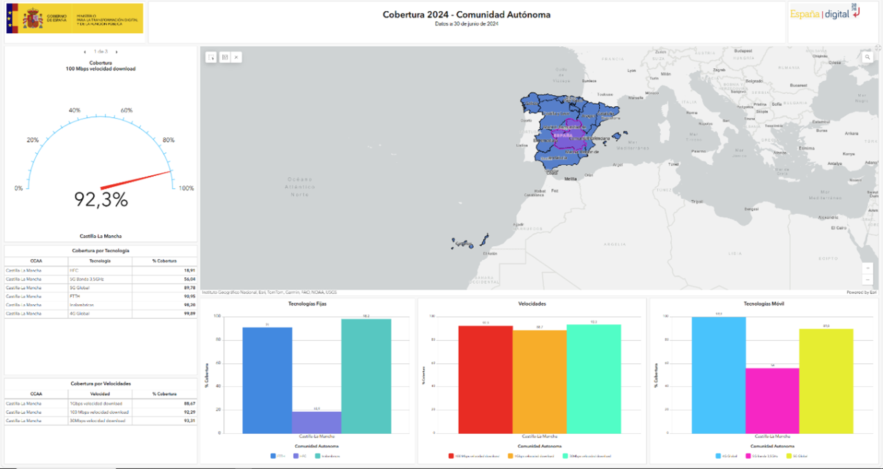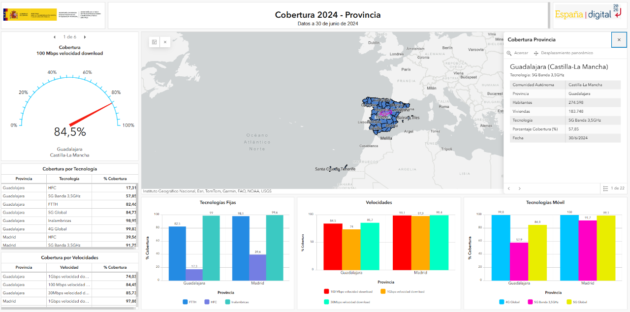
Based on the latest data collected from the operators holding broadband networks, and the methodology developed by the State Secretariat of Telecommunications and Digital Infrastructures (SETELECO), the joint coverage provided by all operators in relation to each technological platform has been obtained, as well as the joint coverage by speed, provided by all operators and technologies, at the level of Autonomous Communities, Provinces and Municipalities.
Cartographic maps allow both geographical representation and broadband coverage indicators to be displayed. It encompasses, on the one hand, access networks from a fixed location and, on the other hand, mobile access networks.